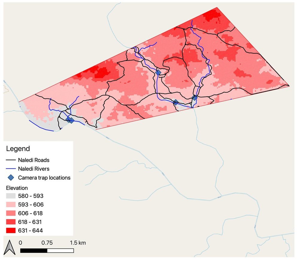
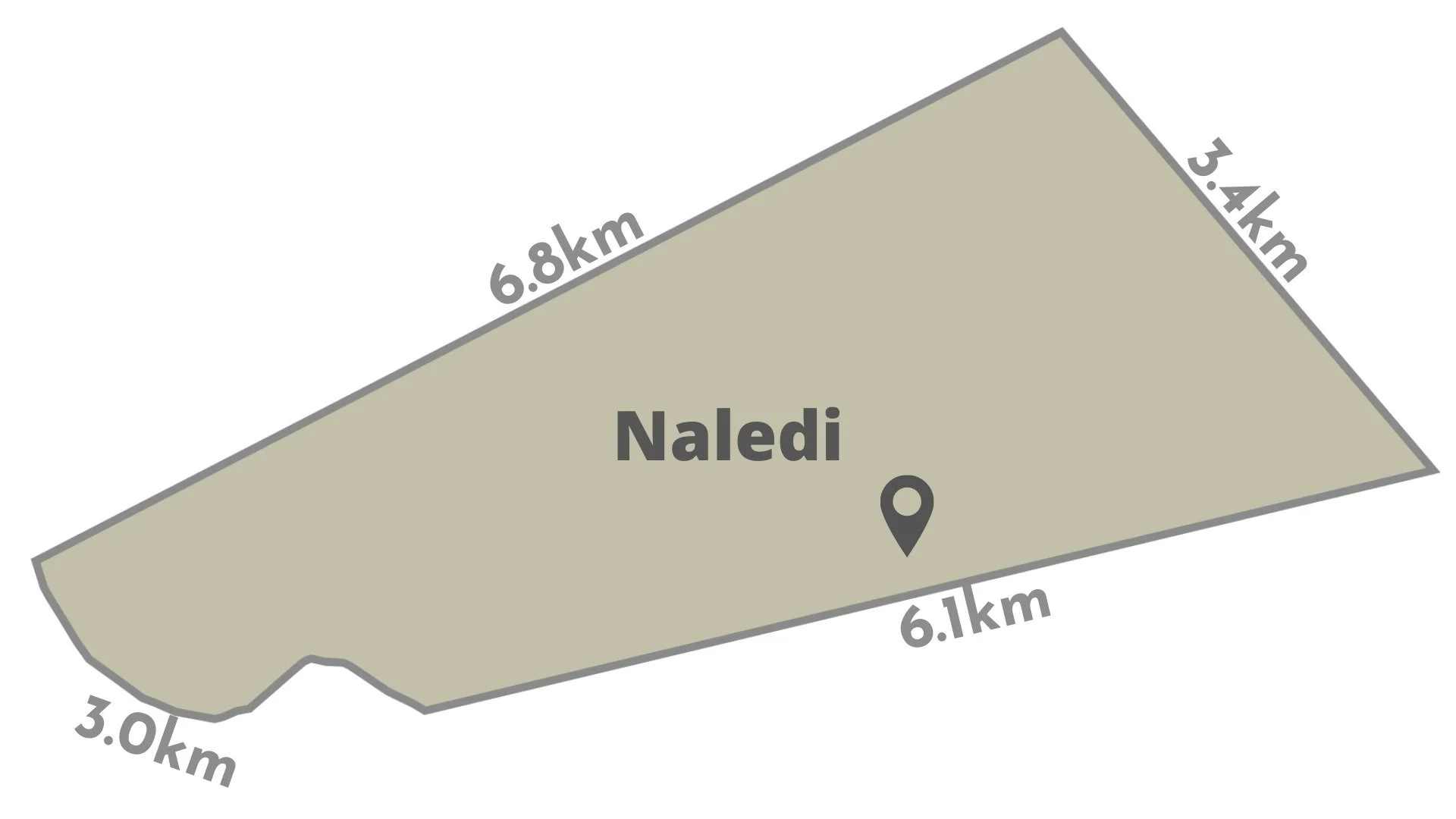
Naledi covers 1,380ha (13.8sqkm), it is covered by semi-arid bushland and the elevation of the property ranges from 580 to 644m. Three main rivers traverse the property, the X, X and X, rivers cover a total 13km within Naledi’s boundaries. Naledi’s roads cover 31.8km. The GPX folders for Naledi’s rivers and roads are available to download at the bottom of this page.
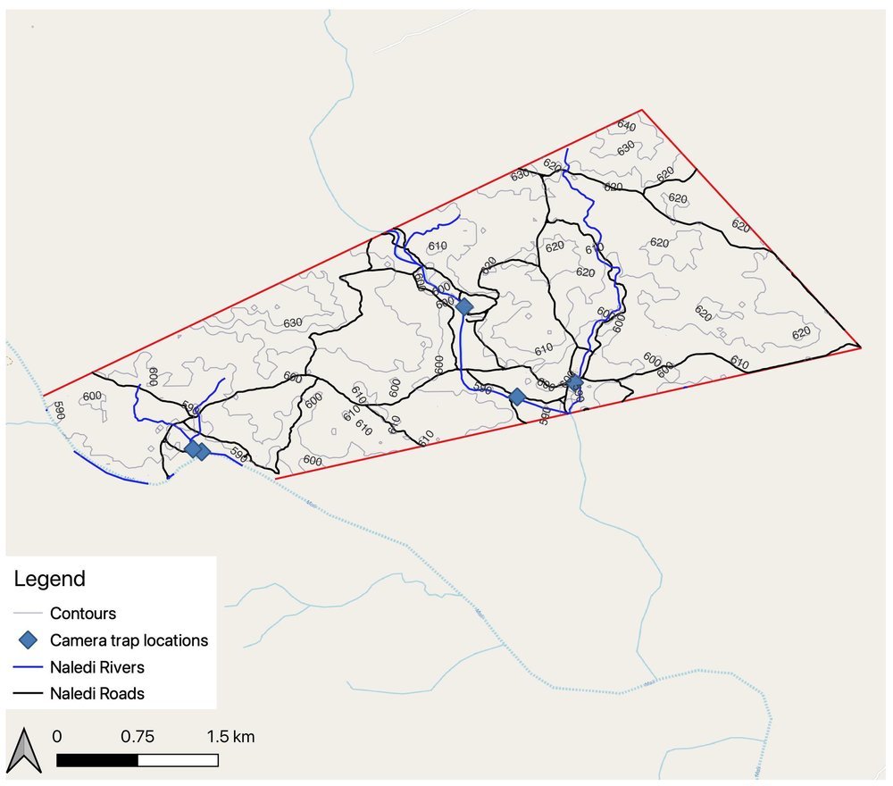
Topographically speaking, Naledi has small undulations and overall there is roughly a 80m difference between the highest point and lowest point on the property. The terrain consists of basalt and geode rich mineral deposits that make the overall terrain rough and weather hardy which makes navigation off road a challenge. This environment coupled with low rainfall makes this a try semi-dessert environment.
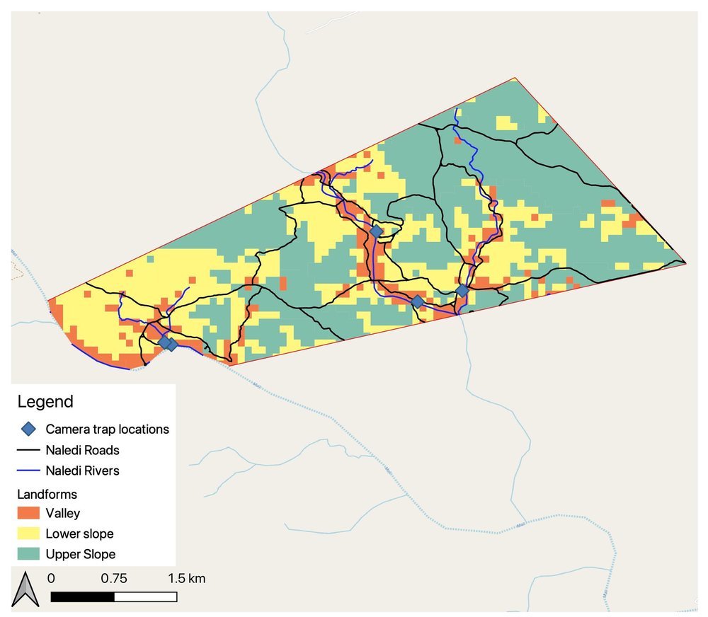
Naledi area layout
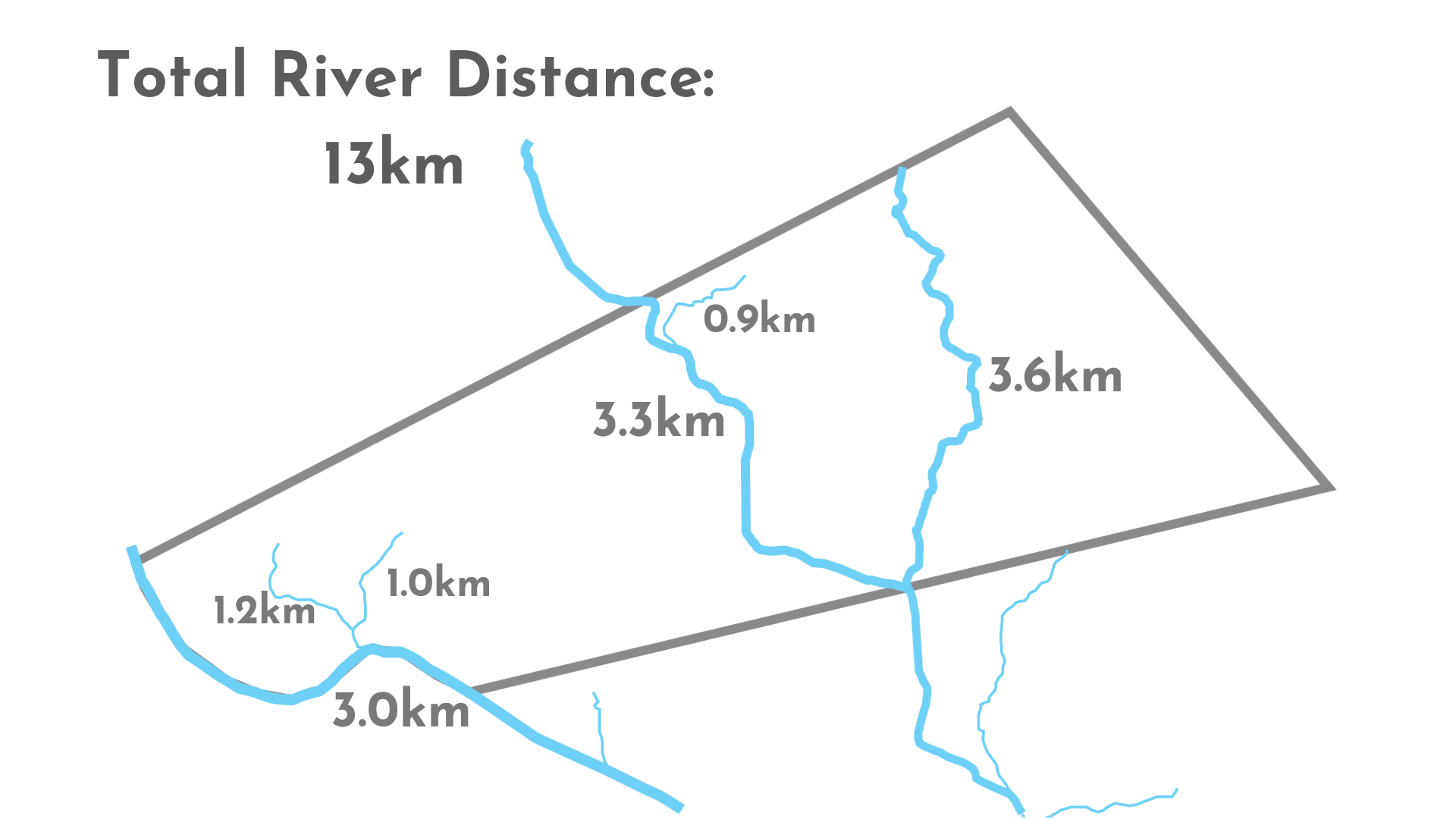
Naledi River Systems
Naledi has 3 main river systems flowing through the property. One of the three has semi-permanent water (Majale) while the the remaining sources (Jawala and Naledi Spruit) have water during the rainy season in Summer. These scarce resources are the life line of Naledi and this is where the highest density of game will be in such a water dependent environment.
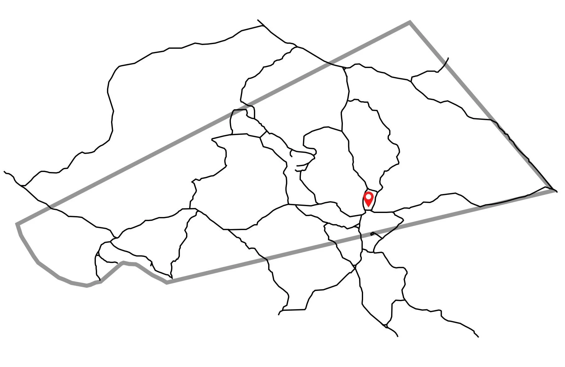
Naledi Road Network
Naledi’s road network covers a large portion of the available land focusing primarily on tracing the water courses and getting to the more remote areas of the property. The relevant GPX files are available for download to use on the Property.
Topographic Maps